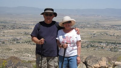
Our friends, Harry and Carroll, told us about a hike near their home. They have hiked half way up the mountain stopping near a large water tank that is in sight of the summet. We were intrigued, so we planned our trek this week to climb the top of that mountain. We parked our car by their home and walked a mile over to the trailhead.
There were a few trails leading up to the top of the mountain. It was a moderate hike and strenuous in some sections as the trail went straight up the hill. We had to watch our footing because there was loose gravel on a very steep trail. Upon reaching the summit, we were rewarded with a fantastic panorama view. There was also a pile of rocks topped with an American flag and solar powered lighting.
FYI: We are curious to know what the name of this little mountain is. It's located near Turtle Drive in Banning. There were no signs at the site and no information on the internet maps. If anyone out there knows, please leave a comment.


No comments:
Post a Comment